
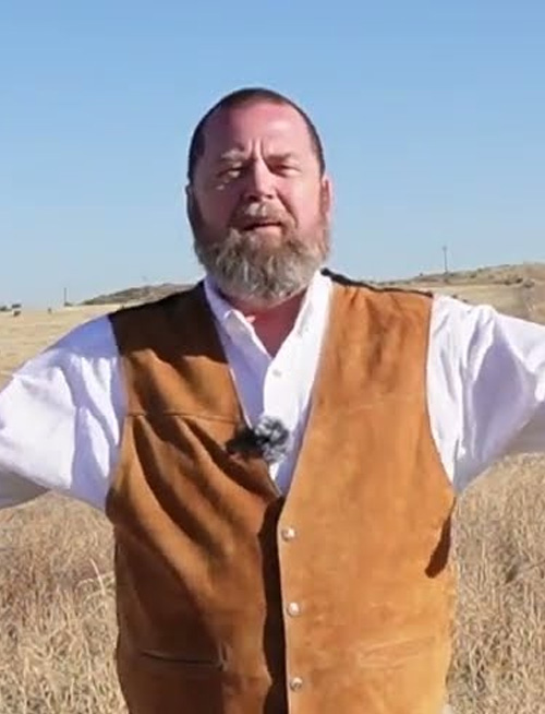
New York Map Society member Roger Karlebach is again generously offering to take up to five of our members (including family members and plus-ones!) at a time on two different three-hour voyages on Long Island Sound on his sailboat Ilene.
The New York Map Society has arranged for a “Members Only” (including members’ families and Plus-Ones!) private tour of an upcoming exhibition at the Hispanic Society by LA-based Chicana artist Sandy Rodriguez: “Tierra Insurgente”.

The New York Map Society presents Bill Rankin speaking about his new book: “Radical Cartography” which includes over 150 full-color maps, many created by the author and by other cutting-edge mapmakers.
Tuesday, February 17, 7:00 pm New York (ET) time, Online: New York Map Society Secretary Andrew Kapochunas has, for over a decade, helped people find an image of their ancestral village on an antique map. He’s decided to show “How to find any village in Central and Eastern Europe on an antique topographical map” to a map audience.
Tuesday, January 27, 7:00 pm New York (ET) time, Online: Jonah Rosenberg, new President of the New York Map Society and head of rare books at Arader Galleries, will speak about “Dutch Gold: Mapping Dominance in the 17th century.
THURSDAY, 22 JANUARY 2026,Speaker: Mark Giordano, Vice Dean for Undergraduate Affairs and Professor of Geography, Georgetown University. Location: Zoom, 7:00 PM ET/6:00 PM CT/5:00 PM MT/4:00 PM PT. Title: Teaching Geopolitics with Maps
Current members only are invited to RSVP to kapochunas@gmail.com to reserve a spot at our “Show & Tell” and Holiday Social (venue TBD).
THURSDAY, 13 NOVEMBER 2025, Arranged in conjunction with the California Map Society. Location: Zoom, 7:00 PM ET/6:00 PM CT/5:00 PM MT/4:00 PM PT. Title: The American Revolution Told in Ten Maps
The New York Map Society offers a private tour for current members only of the Brooklyn Historical Society’s extensive map collection at the Center for Brooklyn History — over 1,500 maps depicting New York City’s five boroughs, Long Island, New England, and beyond, from the 17th century to the present.

The New York Map Society has rescheduled its September 28 event featuring John Tauranac on Subway Maps to October 19 due to the site host’s illness.

Tuesday, October 14, 7:00 pm New York (EDT) time, Washington, Online: Hosted by the Washington Map Society, this Zoom meeting is presented in partnership with the California, Chicago, New York, Philip Lee Phillips, Rocky Mountain, and Texas Map Societies. Henrik Dupont (Map Curator at The Royal Library, Denmark) will discuss Mapping of Greenland, from 1700-2025.
Sunday, September 28, 2:00 pm New York (EDT) time, In-Person: New York City subway riders have no doubt noticed the brand new subway maps (see below). We’ve been lucky to get expert John Tauranac to speak to New York Map Society members in Greenwich Village.
On June 14, members of the New York Map Society enjoyed a special visit to Geographicus Rare Antique Maps in Brooklyn, hosted by map dealer Kevin Brown. Attendees explored a curated selection of rare and historic maps, gaining insight into their provenance and significance.

Saturday, May 24, 1:30 pm New York (EDT) time, In-Person: the New York Map Society will pay the group tour fee for up to 20 current, only, society members at the Morgan Library and Museum for a one-hour “Highlights Tour” led by a Museum Educator.
Sunday, May 4, 11:00 am and 2:00 pm New York (EDT) time, The Bronx, In-Person: repeating a successful September 2018 Long Island Sound sailing trip on New York Map Society member Roger Karlebach’s boat “Ilene,” up to ten current members.

Hosted by the Washington Map Society, this Zoom meeting is presented in partnership with the California, Chicago, New York, Philip Lee Phillips, Rocky Mountain, and Texas Map Societies, this Zoom features Laura Ten Eyck and P. J. Mode discussing Just in Case I Don’t Live Forever, What Should Happen To My Collection?

The New York Map Society invites current members, only, to RSVP to kapochunas@gmail.com for one of a maximum of 20 places for a private tour of an upcoming exhibition at the Grolier Club: Wish You Were Here: Guidebooks, Viewbooks, Photobooks, and Maps of New York City, 1807-1940
Up to 12 current or prospective New York Map Society members are invited to attend (RSVP to kapochunas@gmail.com) WeWork (368 9th Ave, New York, NY 10001), for an exploration of New York City zoning, budget and civic infrastructure data via maps. The State of New York and how its $114 billion budget is spent will be visualized.

Presented in partnership with the California, Chicago, New York, Philip Lee Phillips, Rocky Mountain, and Texas Map Societies. Guided tour of LVA’s new map exhibition, “Mapping the Commonwealth, 1816-1826” by Cassandra Farrell: Exhibition Curator and Senior Map Archivist.
Explore and learn about objects from the Map Collection in a curated talk offered by Special Collections staff. This drop in event will be held in the Map Collection at the Parkway Central Library (1901 Vine Street (between 19th and 20th Streets on the Parkway) Philadelphia, PA 19103) from 11:00am to 11:30am. This event is open to the public and does not require registration.

All are welcome to attend a book talk and signing event for “The Spice Ports: Mapping the Origins of Global Sea Trade,” by Nicholas Nugent, with special reference to New York and Salem. We may think of ‘globalism’ as a recent development, but its origins date back to the fifteenth century and beyond, when seafarers pioneered routes across the oceans with the objectives of exploration, trade, and profit.

A Look Behind “Processing Place: How Computers and Cartographers Redrew our World”. This talk provides a curator’s overview of the latest exhibition from the Leventhal Map & Education Center at the Boston Public Library, Processing Place. The exhibition explores the rise of computer cartography and early…
Saturday, December 14, 1:00 pm New York (ET) time, In-Person: We still have room for six current paid members, only, of the New York Map Society to reserve a spot with kapochunas@gmail.com for a private tour of The Old Print Shop in Manhattan, followed by a Holiday Social Hour at a nearby pub for appetizers and drinks.
Up to 15 current paid members, only, of the New York Map Society are invited to reserve a spot with kapochunas@gmail.com for a private tour of The Old Print Shop in Manhattan, followed by a Holiday Social Hour at a nearby pub for appetizers and drinks.

Dr. Neal Asbury (rare map collector, CEO of Legacy Companies, and host of syndicated weekly radio talk show – Neal Asbury’s Made in America) and Dr. Jean-Pierre Isbouts (historian and professor emeritus, Fielding Graduate University) will speak on “Mapping the Holy Land: An Illustrated Discussion.”

What makes the nineteenth century a distinct period in the history of cartography? Some clues arise from a comparison of the table of contents of Volumes Four, Five, and Six of The History of Cartography, dealing respectively with the Enlightenment and the nineteenth and twentieth centuries.
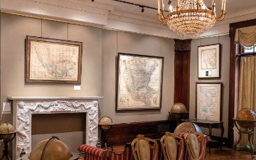
We still have room for six current paid members, only, of the New York Map Society for a field trip to the map-filled Upper West Side apartment of one of our Board members. Refreshments will be provided. Featured are over 25 pictorial maps (two are pictured below), a collection of vintage posters, and an 1855 birds eye view of midtown Manhattan by Wellstood & Smith.

All are welcome to join Laura Ten Eyck, vice president of the New York Map Society, at the Argosy Bookstore for a free presentation and poster map signing by Anton Thomas, a New Zealand artist-cartographer known for his colored pencil illustrated maps. His “Wild World” map, reviewed in The New York Times, has 1,642 wild animals roaming it.

THURSDAY 20 June 2024, Location: Zoom, 7:00 PM ET on Zoom. “Mapping German Americans and Their Communities: Heinz Kloss and His 1974 Ethnographic Atlas” by Heiko Mühr, Map Metadata & Curatorial Specialist, Earth Sciences & Map Library, University of California Berkeley.

Dear Valued 2024 Lifetime or Sustaining Member: You are getting notice of our season-ending Lunch and “Show & Tell” before General members get our Thursday April 18 email. WHERE: Adam Kushner’s Greenwich Village townhouse: 16 Minetta Lane, NYC 10012. WHEN: 12:00 – 2:00 pm, Saturday, May 4.
Thursday, May 2, 3:00 pm New York (EDT) time, Montpelier Room, 6th Floor, Madison Building, Library of Congress.. Lecture 2: “Catawba Cartographies: Remapping the Indigenous Southeast, ca. 1670-1733” byS. Max Edelson, Professor of History, University of Virginia.

Thursday, May 2, 3:00 pm New York (EDT) time, Montpelier Room, 6th Floor, Madison Building, Library of Congress.. Lecture 1: “Extractive Place Naming Practices in Early Modern North America” by Lauren Beck, Canada Research Chair in Intercultural Encounter; Professor of Visual and Material Culture Studies, Mount Allison University, Canada.
Thursday, April 25, 1:00 pm New York (EDT) time, London, Hybrid: the Thirty-Third Series of “Maps and Society Lectures” in the history of cartography will feature Yvonne Lewis (Assistant National Curator) on “Marking the miles: some annotated maps in National Trust collections.”

Thursday, April 18, 7:00 pm New York (EDT) time, Chicago, Hybrid: the Chicago Map Society will host Karen-edis Barzman (Emeritus Professor of Art History) speaking on “Government Mapping in Early Modern Venice.” In 1460 the Venetian republic mandated something unprecedented – the systematic mapping of its territories, combining quantitative and qualitative data in “true pictures” to be archived and consulted in the inner chambers of government.

Friday, April 12, 6:00 pm New York (EDT) time, New York, In-Person: the New York Map Society invites members to attend a talk by Chet Van Duzer at Arader Galleries, 1016 Madison Avenue, between 78th and 79th Street, on “Maps and Power.” “Particularly since the 1988 publication of J. B. Harley’s essay “Maps, Knowledge and Power,” the role maps can play in both the symbolism and the administration of political power has been widely recognized and discussed.

Thursday, April 11, 7:00 pm New York (EDT) time, Milwaukee, Hybrid: Tim Wallace (Senior Editor for Geography, The New York Times) presents the 2024 “Maps & America” Arthur Holzheimer Lecture in the American Geographical Society Library: “Newsroom Cartography.”

THURSDAY 11 April 2024. Location: Zoom, 7:00 PM ET/6:00 PM CT/ 5:00 PM MT/4:00 PM PT. (Sponsored in partnership with California, Chicago, New York, Philip Lee Phillips, Rocky Mountain, and Texas Map Societies). Svalbard, Paradise and Beyond: The Arctic Islands on Medieval and Early Modern Maps.

Thursday, April 11, 2:00 pm New York (EDT) time, London, Online: Susan Schulten (Professor of History, University of Denver) will deliver the International Map Collectors’ Society “Malcolm Young Lecture 2024: “The Cartographic Creativity of Richard Edes Harrison.” From the 1930s through the 1950s, he produced hundreds of stunning maps and graphics that upended the American public’s understanding of geography in a world governed by war and aviation.
Tuesday, April 9, 4:00 pm New York (EDT) time, Faculty House, Columbia University, Hybrid: Chet Van Duzer (member, New York Map Society) will speak on “Animals on Maps and Our Views of the World,” as Seminar 407 of “The Seminar in the Renaissance” “The history of human depictions of animals is as revealing about humans as it is about animals. In this talk I will examine a specific type of depictions of animals, namely those on maps made from the thirteenth to the middle of the eighteenth century, with a focus on animals of the Renaissance.
Tuesday, April 9, 3:00 pm – 4:00 pm New York (EDT) time, Washington, Online: Library of Congress reference librarians Amelia Raines and Julie Stoner will present “An introduction to the LOC’s fire insurance maps.” This orientation session will highlight the background of fire insurance mapping, the Sanborn map collections, and fire insurance maps made by other companies held in their division.

Sunday, March 24, 2:00 pm New York (ET) time, In-Person: The New York Map Society invites all New York-area map lovers – members and non-members — to join us for a self-guided tour of the New York Historical Society’s immersive exhibit: “New York Before New York: The Castello Plan of New Amsterdam.” As a Lifetime or Sustaining member, you can ask me, at kapochunas@gmail.com, to reimburse you, via PayPal, for the admission ticket you will have to buy for March 24 at 2:00 pm: Adults: $24; Seniors/ Educators: $19. Buy your ticket(s) HERE. “On the occasion of the 400th anniversary of the Dutch founding of a colony that would give rise to New York, this special installation is organized around the Castello Plan, a map depicting New Amsterdam around the peak of its settlement circa 1660.”

THURSDAY 14 March 2024, Location: Zoom, 7:00 PM ET/6:00 PM CT/ 5:00 PM MT/4:00 PM PT (Arranged with assistance of Rocky Mountain Map Society; sponsored in partnership with California, Chicago, New York, Philip Lee Phillips, Rocky Mountain, and Texas Map Societies). Why We Collect Road Maps: In this well illustrated presentation, Spaid will enumerate reasons why it is important to collect road maps.

Sunday, January 28, 2:00 pm New York (ET) time, New York, In-Person: the New York Map Society presents, for up to 12-15 2024 paid-members-only, Peter Lloyd on The History and Design of Transit Maps. “I have been researching the history and design of the New York City subway maps for a number of years. In 2012 I published “Vignelli: Transit Maps,” based on interviews with Massimo Vignelli, and others, as well as archival research. I am preparing several further volumes documenting the history of the NYC subway map since its inception.”
Thursday, January 25, 12:00 noon New York (ET) time, London, Hybrid: the 33rd Series of “Maps and Society Lectures,” all free, in the history of cartography features Felix de Montety (Université Grenoble Alpes, France) on The Birth of the Isogloss: Remarks on the Problem of Language Borders in the History of Cartography.

THURSDAY 18 January 2024
Location: Zoom, 7:00 PM ET/6:00 PM CT/ 5:00 PM MT/4:00 PM PT
(Arranged with assistance of Rocky Mountain Map Society, sponsored in partnership with California, Chicago, New York, Philip Lee Phillips, Rocky Mountain, and Texas Map Societies). Herman Moll and John Senex: Mapping North America in the Early 18th Century (from the British Point of View)
Tuesday, January 16, 7:30 pm New York (ET) time, Denver, Hybrid:Join with the Rocky Mountain Map Society to hear local trail researcher Larry Obermesik on a journey through a forgotten chapter of Colorado’s past. His presentation, Mapping the Cherokee Trail: Colorado’s Forgotten Highway.

WEDNESDAY 6 December 2023. Location: Zoom, 7:00 PM ET/6:00 PM CT/ 5:00 PM MT/4:00 PM PT.
The Changing Map of the Island of Enchantment: Puerto Rico and the Spanish-American War of 1898. (Arranged with the assistance of the Texas and Rocky Mountain Map Societies; sponsored in partnership with California, Chicago, New York, Philip Lee Phillips, Rocky Mountain, and Texas Map Societies).

Courtney Chartier, director of Columbia Libraries’ Rare Book & Manuscript Library, will lead the NYMS on a tour of the Rare Book Manuscript Library, where she will highlight some key pieces from the collection.
Using GIS to Tease Information from Historic Maps in the Search for Old Roads. Searching for a simple answer to a naive question lead Loberger on a personal and professional journey. The intent to discover a road uncovered a path that will lead researchers to better appreciate and predict where transportation infrastructure once existed. The key lies in improving our understanding of the testimony presented by the cartographic witnesses of any inquiry.
Saturday, October 28, 2:00 – 4:00 pm: current paid members of the New York Map Society are invited to reserve one of up to 15 spots for a visit to the map-filled Manhattan apartment of society members Kathleen & Joseph Porder. “The strengths of our map collection: Ortelius, Mercator/Hondius, early regional Americas, and New York City. Our town views include those by Braun and Hogenberg, Piranesi’s views of Rome, and many other early town views. First emailed to kapochunas@gmail.com, first served.
Thursday, October 26, 3:00 – 4:00 pm, and 7:00 – 8:00 pm New York (ET) time (two meetings), Hybrid: The Philip Lee Phillips Society (PLPS) will have two meetings at the Library of Congress.
The first presentation will be given by Ernesto Capello (Professor, History Department, Macalester College) on the allegorical, commercial, and political uses of Mapping Mountains. The second presentation will feature Edward Brent Lane (Fellow of Global Heritage Economics, Global Research Institute, University of North Carolina at Chapel Hill) on John White’s 1585 Map of the North Carolina Outer Banks.

Arranged with the assistance of the Rocky Mountain and Texas Map Societies; sponsored in partnership with California, Chicago, New York, Philip Lee Phillips, Rocky Mountain, and Texas Map Societies. The Role of Maps in Films about Exploration and Discovery: Some Latin American Examples. Speaker: Richard Francaviglia, Professor Emeritus, University of Texas at Arlington; currently Associated Scholar, Willamette University, Salem, Oregon
Courtney Chartier, director of Columbia Libraries’ Rare Book & Manuscript Library, will lead the NYMS on a tour of the Rare Book Manuscript Library, where she will highlight some key pieces from the collection.

Wednesday, June 14, 7:00 pm New York (ET) time on Zoom: “Key West and the Florida Keys: Mapping the History of the Conch Republic”.
Much of that history is represented in maps, charts, and tourist brochures, which are featured in the Tampa Bay History Center’s latest exhibition in the Touchton Map Library – Key West and the Florida Keys: Mapping the History of the Conch Republic.

Saturday, May 13, 2:00 pm New York (ET) time, In-Person: Jonah Rosenberg, head of rare books for Arader Gallery at 1016 Madison Ave., will host a private tour, for Members-Only, of the New York Map Society. Jonah looks forward to welcoming members of the New York Map Society for a tour of Arader’s beaux-arts townhouse. The public is not ordinarily permitted above the third floor, but this tour will include the whole of the house, from the fifth floor (with maps by Ruysch, Cimerlinus, Valk, Gastaldi, Hubbard and Price inter alia) down.

Up to 20 New York Map Society 2023 members, only, will meet at 10:45 am in Fordham University’s Walsh Family Library lobby, 441 E Fordham Rd, The Bronx, NY 10458. We will review maps in a conference room with Special Collections Librarian Gabi/Gabriella DiMeglio, and then quietly and individually view New Amsterdam maps on display in the Reading Room. Per University requirements, all visitors will have to show photo IDs and proof of Covid vaccination to show guards at the campus gates.
Wednesday, April 19, 2023. Behold the Mapmaker: Cartographic Self-Portraits. The lives of early modern cartographers are poorly documented compared with those of contemporary writers and painters, yet a source for insights into the lives of cartographers—the self-portraits that they sometimes include in their maps—is largely unexplored. These self-portraits are an important part of the social history of cartography, of how cartographers chose to present themselves; they also function as visual signatures, guarantees of quality, and expressions of pride.

THURSDAY March 16, 2023. Open-Source Maps: Mapping the Russian Invasion of Ukraine.This briefing will focus on the Institute for the Study of War’s open-source methodology as their team collects, processes, analyzes, and interprets data that supports their maps and written prose assessments. The brief will also present analytical decisions ISW has made on how they structure maps, what they show and do not show, how they do source characterization, caveat confidence levels, and leverage remote sensing technology.
We’re excited to tell you about our first in-person members-only “Show & Tell” and Social Hour since December 2019. Saturday, February 11, 2023, 2:00 – 4:00 pm at Ned Davis’ map-filled Manhattan apartment. First come, first served, for 2023 paid members only, with a limit of 10 presenters and a total of 20 attendees. Your society will pick up the cost of appetizers, soft drinks, wine and beer.

Thursday, February 16, 2023 (Organized in conjunction with the Library of Congress Philip Lee Phillips Society)
The Mapping of Race in America: The Legacy of Slavery and Redlining from 1860 to Present. The mapping of the racial demographics of the United States has a long and difficult history. From the earliest counts of enslaved individuals and the practice of redlining, to the under counts of various groups in modern Census tabulations, there have always been questions about both its purpose and its accuracy.

Thursday, 5 January 2023 (Arranged with assistance of New York Map Society; sponsored in partnership with California, Chicago, New York, Philip Lee Phillips, Rocky Mountain, and Texas Map Societies). This talk will explore the reasons for the continued wars, will show many examples of divergent maps published during this time, and will show the maps used by President Wilson’s cartographers in coming up with Versailles-recommended (and ignored) Polish-Lithuanian borders.

Wednesday, December 14, 2022, 7:00 pm New York (ET) time (Online): The California, Chicago, New York, Philip Lee Phillips, Rocky Mountain, Texas, and Washington Map Societies are offering a virtual lecture by Francis Manasek (retired professor, Dartmouth Medical School; former antiquarian map dealer; author of “Collecting Old Maps” and “A Treatise on Moon Maps”) on “The Birth of Moon Maps: Looking Through the Telescope, 1610-1696.”

Wednesday, November 30, 2022, 7:00 pm New York (EST) time (Online): The California, Chicago, New York, Philip Lee Phillips, Rocky Mountain, Texas, and Washington Map Societies will offer a virtual lecture by Thomas Horst on “The Amazing (Hi-)Story of the Bavarian Army Library Map Collection – Reconstructed 60 Years After Its Restitution to Germany.”

Saturday, November 19, 2022, 2:00 pm. We will meet at 1:45 pm at the Fifth Avenue entrance of the main branch of the New York Public Library for a Field Trip. Ian Fowler (Curator and Geospatial Librarian for the Lionel Pincus and Princess Firyal Map Division at The New York Public Library) will personally guide society members through the “Polonsky Exhibition of the New York Public Library’s Treasures”.

Based upon his recently published book Ancient Explorers and Their Amazing Maps, Les Trager will discuss a body of Western 16th Century Maps which cannot be explained by the discoveries of European explorers. He will show that the leading 16th century map-makers understood that they were copying maps made by the “ancients.”

Tuesday, April 26, 2022, 7:00 pm New York (ET): the New York Map Society presents Rick Smit, a map collector living in The Netherlands, speaking about his Berghaus Map of Syria, published 1835 by the German publishing house Justus Perthes. He will explain the sources Berghaus used, the context under which the map was published, and the new elevation depiction method applied in making the map: hachures.

Tuesday, February 15, 2022, 7:00 pm New York (ET) time: Jennifer Thermes, author and map illustrator, will discuss her award-winning book “Manhattan: Mapping the Story of an Island.” From before its earliest settlement to the vibrant metropolis that exists today, the island of Manhattan has always been a place of struggle, growth, and radical transformation.

Renowned poster experts present their favorite posters with maps.

Holiday Show & Tell, Raffle, and Elections.

The 2020 Census, along with the American Community Survey, provide a snapshot of the demographics of the American population like no other sources available. Combined they tell the story of the spatial distribution of everything from health care, cell phone ownership, housing expenditures and the level of poverty in the United States by age, gender and race.

Shannon Mattern will discuss the class she teaches at New York City’s The New School: Mapping the Field.
Anthony Mullan (Library of Congresss) will discuss late 19th century maps of Cuba.

John Hessler (Library of Congress) will speak on It Came From a Blue Sky: Mapping Bats and Spillover of Covid-19.

Mark Monmonier, Distinguished Professor Emeritus, Geography and the Environment, Syracuse University on “Adventures in Academic Cartography.”

Max Peeters on “The Golden Age of Cartography and the 80 year war of independence in The Netherlands.”

President/Head Curator of the Osher Map Library Garrett Dash Nelson will present “Don’t Believe Me On This: Engaging With Truth and Skepticism Through Maps & Data.”
The Boston, California, Chicago, New York, Philip Lee Phillips, Rocky Mountain, Texas, and Washington Map Societies sponsor Andrew J. Rhodes on “James Monteith: Cartographer, Educator, and Master of the Margins.”

Historian Lindsay Frederick Braun spoke on “Mapping in 19th Century Africa”. “My work over the last decade and a half has involved surveying, mapping, and struggles over land and landscape in South Africa between the middle of the…

Cartographic historian and New York Map Society member Chet Van Duzer spoke on “Shipwrecks, Treasure, and Maps at the End of the Seventeenth Century: The Manuscript Atlases of William Hack.” In this talk, following a…

“Mapping Indigenous Land: Native Land Grants in Colonial New Spain” by Ana Pulido Rull

“Women in American Cartography: An Invisible Social History”. “The nation’s foremost expert on women’s contributions to maps, mapmaking, and map use, Tyner draws on her own research and that of others to produce…

Andrew Kapochunas on “New York’s Newtown Creek: Death and Resurrection – A Chronicle in Maps and Photographs.”

Dr. Larry Tise spoke about his recent co-authored book, “Theodore De Bry — America: The Complete Plates from 1590-1602”

Lars Grava on “At the Edge of Empires – Maps of the Baltic States”. The Baltic States of Estonia, Latvia and Lithuania have been at the crossroads of neighboring powers for centuries…

Eric W. Sanderson’s update to his “Welikia Project.” “We’re going beyond ‘Mannahatta,’ launching the Welikia Project to encompass all of New York…
“Just in case I don’t live forever, what should happen to my collection?”
Ian Fowler on “Cartographic Visions of New Netherland and New Amsterdam”. Ian took us on an exploration of the history of the shifting populations of Manhattan..

John Huth expands on his book: “The Lost Art of Finding Our Way.”
“I’ll be examining the post-smartphone world with an eye to the losses we have incurred in exchange for boundless…

Chet Van Duzer on “Frames that Speak: An Introduction to Cartographic Cartouches”

Matthew Edney on “The History of Cartography Project”. From prehistoric Europe to the 20th century, societies have employed the principles of…

Cartographic historian Susan Schulten spoke on “How Maps Illuminate and Complicate the Past.”

Cartographer Christina Dando presented “Maps in Motion: American Public Map Making of the Progressive Era.”

Cartographer S. Max Edelson: “The New Map of Empire: How Britain Imagined America Before Independence.”

Daniel Crouch: “There are three kinds of lies: lies, damned lies, and statistics.”

Priyamvada (Priya) Natarajan recounted the evolution of celestial map-making and showed how maps literally track our ever-evolving cosmic view, tracing our understanding of the universe, its contents, and its development.

Talk by pictorial cartographer Anton Thomas on his hand-drawn map of North America. Anton Thomas began drawing a pictorial map of North America in 2014 and, four years later, it is finally finished. With thousands of features from Alaska to Panama, and hundreds…

Best-selling author, editor, and map collector Colin Harrison’s latest novel, “You Belong to Me,” features a protagonist who is a devoted collector of the maps of New York City — as is Mr. Harrison.

Field Trip to the NY Historical Society for a private tour of “Mapping America’s Road from Revolution to Independence”
“’With Savage Pictures Fill their Gaps’: On Cartographers’ Fear of Blank Spaces,” by noted map historian Chet Van Duzer.

“Trail Maps Then & Now: Looking Back at 100 Years of Mapping Trails,” by cartographer Jeremy Apgar.