
Thursday, 5 January 2023 (Arranged with assistance of New York Map Society; sponsored in partnership with California, Chicago, New York, Philip Lee Phillips, Rocky Mountain, and Texas Map Societies)
Location: Zoom, 7:00 PM ET/6:00 PM CT/ 5:00 PM MT/4:00 PM PT. RSVP is required. Please email John Docktor at washmap@gmail.com to receive the Zoom link.
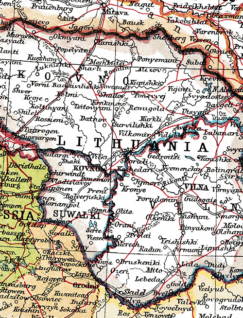
Title: The Struggle of Mapmakers to Keep Up with Changing Post-WWI Boundaries Between Lithuania and Poland
Speaker: Andrew Kapochunas, Secretary of New York Map Society, member of Lithuanian Cartographic Society, retired data and processing consultant
Summary: As World War I officially came to an end: the Treaty of Versailles, signed June 28, 1919, map and atlas publishers struggled to depict redrawn Europe, particularly Poland and Lithuania, where armies of Russians, Poles, Lithuanians, Latvians and Germans continued to jockey for possession of land. Negotiated cease-fires and boundaries were repeatedly agreed-to and then ignored, leaving published maps continuously out of date. While boundaries between Poland, Lithuania and Russia were finally set March 28, 1921 by the Peace of Riga, out-of-date maps of the area continued to be published for many years. This talk will explore the reasons for the continued wars, will show many examples of divergent maps published during this time, and will show the maps used by President Wilson’s cartographers in coming up with Versailles-recommended (and ignored) Polish-Lithuanian borders.