Alice Hudson has been a force in the field of map librarianship for many years. Over her distinguished career, she helped guide and mentor countless scholars, colleagues, and students. Her curatorial and collection work at the New York Public Library helped establish the New York Public Library’s Map Division as one of the premier public map collections in the world. Her research into the history of cartography, particularly her work highlighting the contributions of women in the field of mapmaking, continues to inform and inspire today’s researchers. Alice also has a strong connection to the Department of Geography and Environmental Science at Hunter College and is a past recipient of the Anastasia Van Burkalow Award for Distinguished Service: 1994.
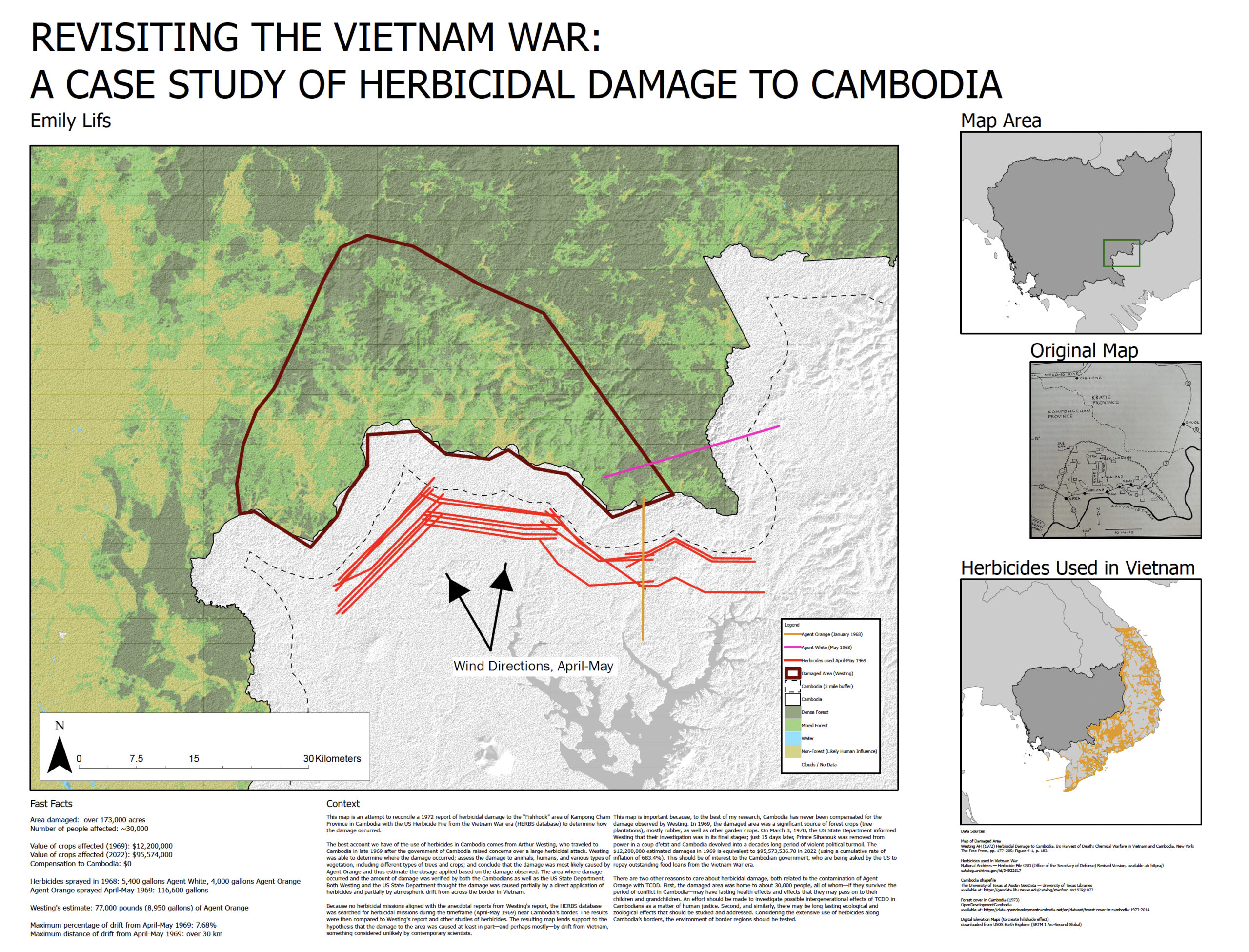
Winner for Physical Map: Emily Lifs, for her map on Cambodia and the impact that war has had on the natural landscape.
Emily Lifs is a masters student in the Department of Geography and Environmental Science at Hunter College, part of the City University of New York (CUNY). She is a geographer interested in conservation, biogeography, natural landscapes, human-nature interactions, and historical maps. Her thesis, “Conflict and Nature: How War in Cambodia Shaped Its Natural Landscape,” broadly examines the different pathways through which the Cambodian natural landscape and ecology were shaped by war, from the military aspects of war to the societal upheaval it causes.
We selected this map because of its creativity, the application of multiple research resources, production techniques, and social consciousness.

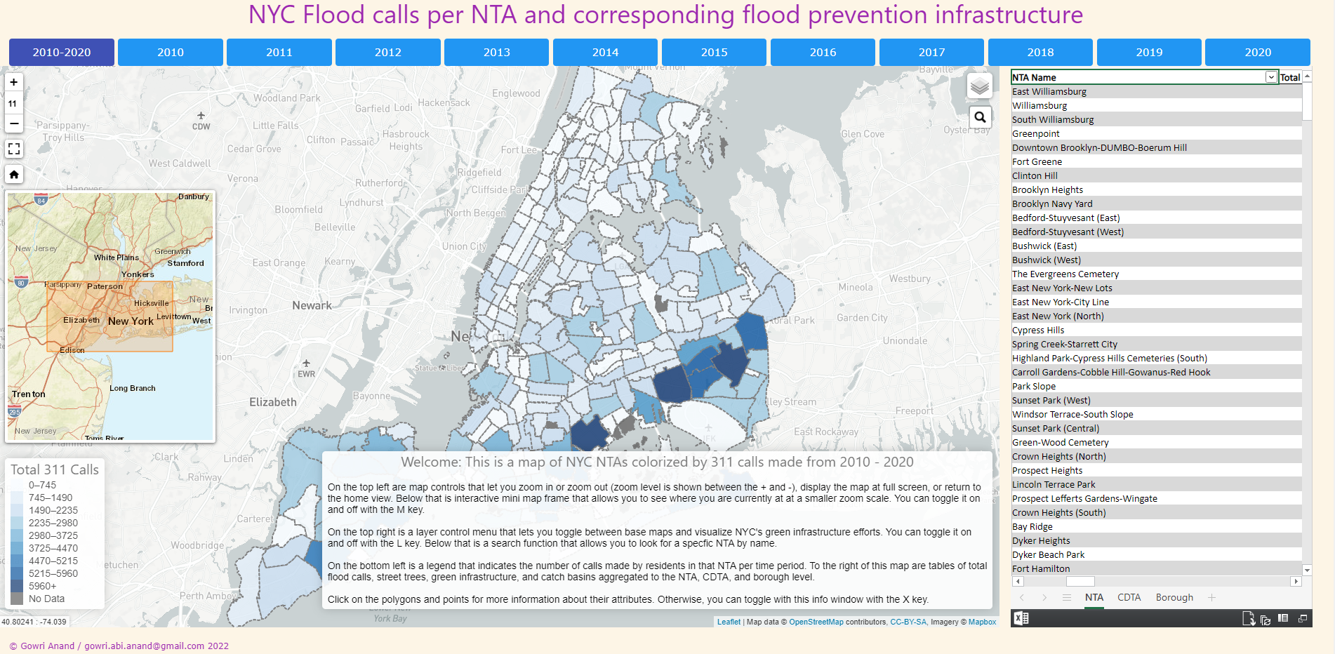
Winner for Digital Map: Gowri Anand, for her map on 311 calls relating to flood events in NYC.
Gowri Anand is currently a graduate student in the MS Geoinformatics program at Hunter College, with a bachelor’s in environmental biology from New York University. Her previous research ranges from studying spatial dynamics of infected nymphal prevalence and tick-borne diseases in Dutchess County to trends in greenhouse gas emissions in Asian cities. Her current research involves investigating spatial trends of heat and flooding in New York City that are exacerbated by climate change and identifying which communities are disproportionately affected by these issues. Her research interests include spatial dynamics of disease and environment and how rapid climate change affects these dynamics.
We selected this map because it was informative, had easy-to-navigate layers, and had an excellent description and navigation instructions.

