New York Map Society member Roger Karlebach is again generously offering to take up to five of our members (including family members and plus-ones!) at a time on two different three-hour voyages on Long Island Sound on his sailboat Ilene.
Read More
The New York Map Society has arranged for a “Members Only” (including members’ families and Plus-Ones!) private tour of an upcoming exhibition at the Hispanic Society by LA-based Chicana artist Sandy Rodriguez: “Tierra Insurgente”.
Read More
The New York Map Society presents Bill Rankin speaking about his new book: “Radical Cartography” which includes over 150 full-color maps, many created by the author and by other cutting-edge mapmakers.
Read More
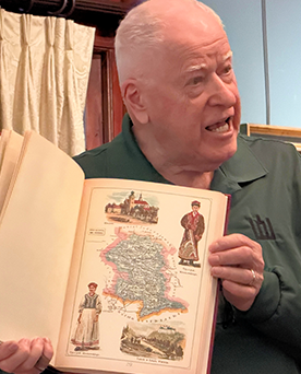
Tuesday, February 17, 7:00 pm New York (ET) time, Online: New York Map Society Secretary Andrew Kapochunas has, for over a decade, helped people find an image of their ancestral village on an antique map. He’s decided to show “How to find any village in Central and Eastern Europe on an antique topographical map” to a map audience.
Read More
Tuesday, January 27, 7:00 pm New York (ET) time, Online: Jonah Rosenberg, new President of the New York Map Society and head of rare books at Arader Galleries, will speak about “Dutch Gold: Mapping Dominance in the 17th century.
Read More
THURSDAY, 22 JANUARY 2026,Speaker: Mark Giordano, Vice Dean for Undergraduate Affairs and Professor of Geography, Georgetown University. Location: Zoom, 7:00 PM ET/6:00 PM CT/5:00 PM MT/4:00 PM PT. Title: Teaching Geopolitics with Maps
Read More
Current members only are invited to RSVP to kapochunas@gmail.com to reserve a spot at our “Show & Tell” and Holiday Social (venue TBD).
Read More
THURSDAY, 13 NOVEMBER 2025, Arranged in conjunction with the California Map Society. Location: Zoom, 7:00 PM ET/6:00 PM CT/5:00 PM MT/4:00 PM PT. Title: The American Revolution Told in Ten Maps
Read More
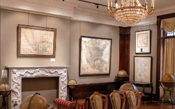
The New York Map Society offers a private tour for current members only of the Brooklyn Historical Society’s extensive map collection at the Center for Brooklyn History — over 1,500 maps depicting New York City’s five boroughs, Long Island, New England, and beyond, from the 17th century to the present.
Read More
The New York Map Society has rescheduled its September 28 event featuring John Tauranac on Subway Maps to October 19 due to the site host’s illness.
Read More